22 April 2026
Rous County Council (Rous) has partnered with leading researchers from Griffith University to map critical areas of erosion following the 2022 floods, as part of a long-term strategy to improve the health of the Richmond River.
Partially funded by the NSW Department of Climate Change, Energy, the Environment and Water, the year-long study identified areas of significant waterway erosion and mapped 1,600 landslides across the catchment feeding into the Richmond River.
The research focused on channel erosion in the Richmond River catchment, which has been shown to be the dominant cause of sediment in many rivers across sub-tropical eastern Australia.

Image: Richmond River sediment plume following cyclone Alfred
Led by Adjunct Professor Andrew Brooks, a renowned fluvial geomorphologist at Griffith University, the study contrasted historical LiDAR imagery with post-flood 2022 datasets. This allowed researchers to pinpoint erosion ‘hot spots’ – areas where significant geomorphic change has occurred.
The study identified approximately 3.3 million cubic metres of erosion over the past decade, with major contributions from the 2017 and 2022 flood events, according to Adj Prof Andrew Brooks.
“Within the catchment area analysed, we identified ~ 1600 landslides triggered during the 2022 flood that generated approximately one million cubic metres of erosion,” said Adj Prof Brooks.
One of the key threats to the health of the rivers and waterways is the build-up of sediment caused by channel erosion across the catchment, according to Anthony Acret, Catchment and Cultural Awareness Manager, at Rous.
“When sediment flows into the rivers, it clouds the water and harms aquatic plants, fish, and overall water quality,” Anthony Acret said.
“Many residents of the Northern Rivers who have seen the Wilsons and Richmond Rivers after a rain event will recognise this muddy colour.
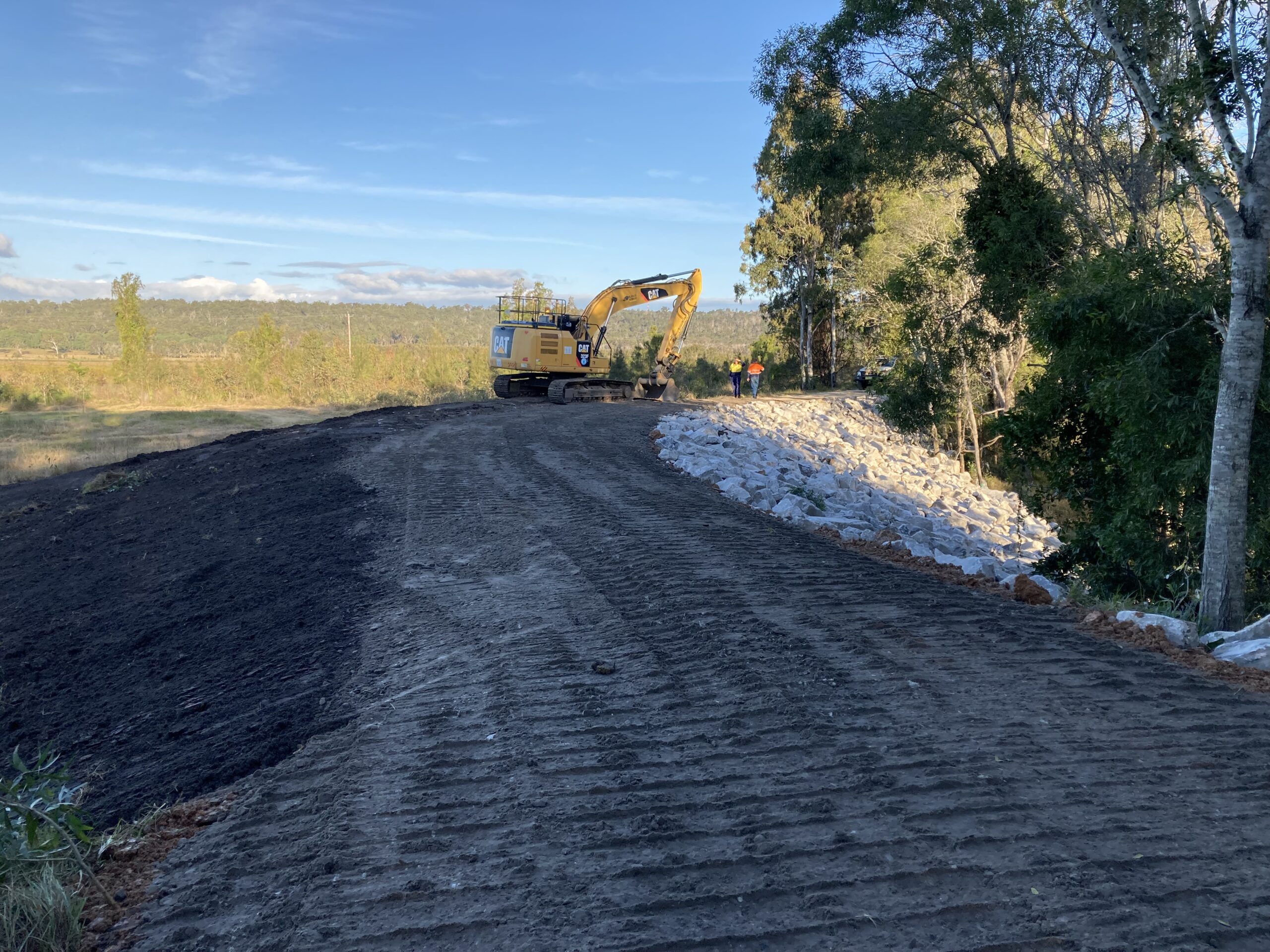
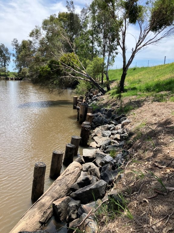
“The study found most erosion is occurring in the upper and middle reaches of the catchment. These upstream impacts ultimately affect river and estuary health downstream.
“Investing in revegetation, improving soil health and stabilising riparian zones are practical actions that can make a real difference.
“The 2022 floods had a profound impact on our region. This research gives us, for the first time, a detailed, catchment-wide picture of where erosion has occurred so we can prioritise repair and rehabilitation efforts.”
This project forms part of the Richmond River Coastal Management Program (CMP), led by Rous. The CMP is designed to deliver a long-term strategy and coordinated management actions for the Richmond River estuary.
Rous is working in partnership with the NSW Government on the CMP, in collaboration with Ballina Shire Council, Lismore City Council, Richmond Valley Council, Kyogle Council, Byron Shire Council and catchment stakeholders.
According to Phillip Rudd, General Manager of Rous, the county council is focused on a catchment-wide approach to improving the condition of the region’s rivers and waterways.
“The CMP complements the work we are undertaking through the Northern Rivers Watershed Initiative and our proposed plan, Operation Richmond River Recovery,” Phillip Rudd said.
“Each program targets a different aspect of ecosystem health, collectively contributing to the overall improvement of the region’s rivers and waterways,” Phillip Rudd said.
“Moving forward, we will share the detailed report and its findings with our CMP partners and catchment stakeholders.
“The report, titled ‘Sediment Pollution Sources to the Richmond River,’ is essentially a blueprint that will help us to identify priority areas for erosion repair to reduce sediment entering the river, as part of our long-term catchment health strategy.”
The report is available to view on Rous’ website. Click here for the report. Click here for the project webpage.
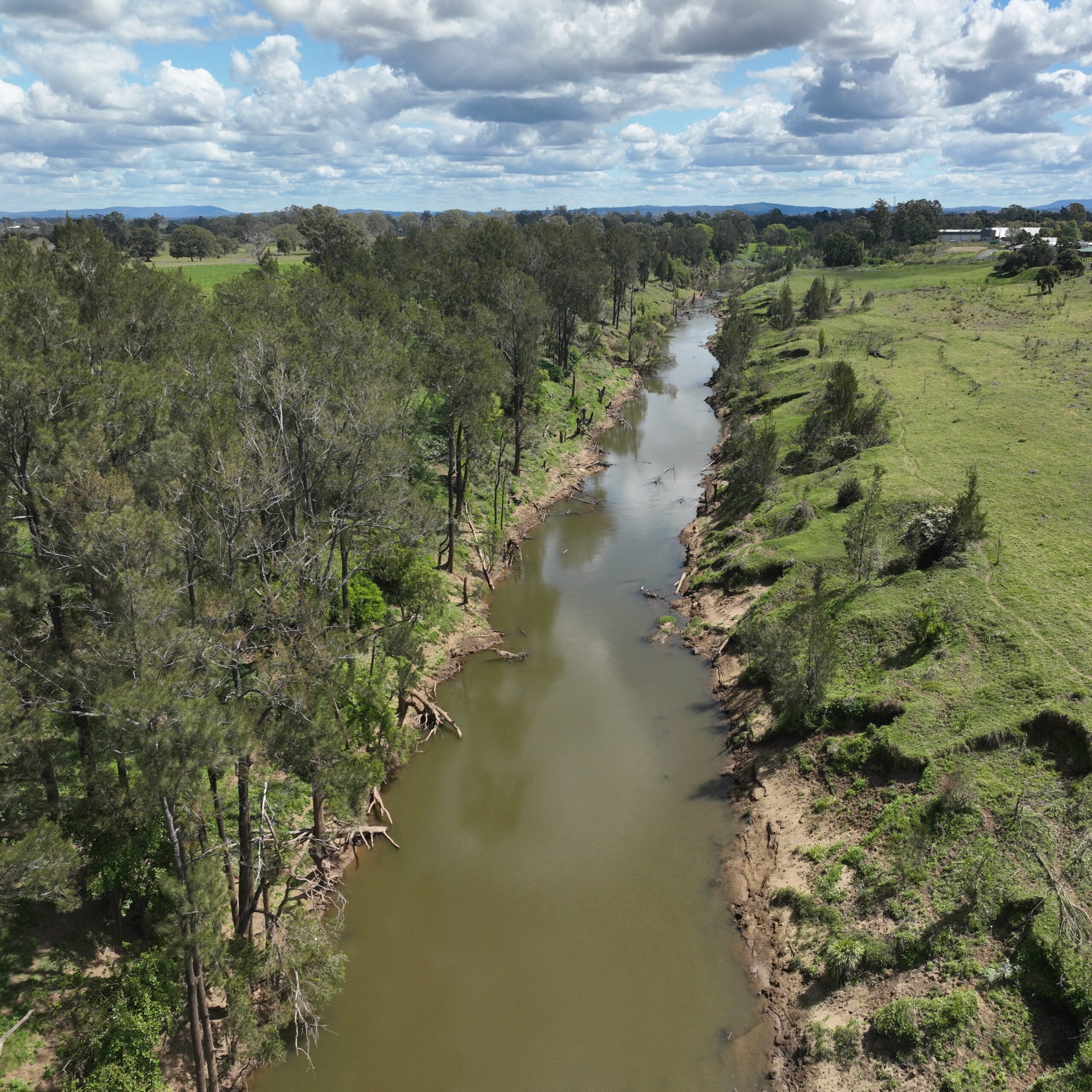
Image: The year-long study identified areas of significant waterway erosion